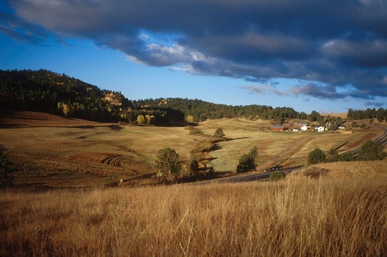
In the past three years alone, Teller County has lost over 2000 acres of ranch land. Residents don’t need the numbers, however, to know what is happening; the visual impact is clear.
In an effort to preserve the rural character, the scenic beauty, and the natural resources that make Teller attractive to residents and tourists alike, a group of concerned citizens organized the Rural Land Preservation Group in 1999. The Rural Land Preservation Group (RLPG) is made up of ranchers and other landowners, representatives of parks, trails, and open space organizations, county officials, and interested citizens.
The premise of the Teller land preservation program is that ranch land represents not only the livelihood of ranchers and their families, but a vital asset to the community as a whole. The hay meadows and the pastures and the untrammeled woods that frame Teller’s famous views of Pikes Peak draw dollars into the local economy from visitors seeking respite from urban stress.
The goal of RLPG is to help ranchers who wish to keep their land in the family and in production and, in the process, preserve some of Teller’s most valuable public assets. Participation on the part of any rancher is entirely voluntary. RLPG’s role is to research opportunities and provide ranchers with the best possible information about the options that are available.
Pikes Peak Conservation Corridor
Preservation of the exceptional landscape along the Pikes Peak Corridor has its roots in the 1990s when Teller County drew up master plans based on community priorities. Top among those priorities were “to recognize Pikes Peak and the view toward the mountain as the county’s most important, environmentally significant resource and to encourage protection of ranch and range lands as important natural and economic resources.”
In 1999, the Rural Land Preservation Group was formed. The joint efforts of RLPG, Teller County Division of Parks, and Palmer Land Trust over more than a decade resulted in the Pikes Peak Conservation Corridor. This great mosaic of protected private and public lands is located south of Highway 24 between Woodland Park and Divide.
One transaction, which took place December 30, 2005, completed protection of 5,500 acres of scenic ranch land and wildlife habitat now preserved “in perpetuity” through conservation easements. Those 5,500 acres border the Pike National Forest and the North Slope Recreation Area which more than double their area. Since then, other tracts of considerable land have been added to the Pikes Peak Conservation Corridor.
The contiguous swath of open space secures Teller County’s trademark landscape. It protects critical watersheds, as well as forage, migration corridor, and calving grounds for elk.
The effort has since been expanded by Palmer Land Trust to include properties along the Gold Belt Scenic Byway.
